
Unlock the Sky’s Potential: Your Ultimate Guide to Drones, Cameras, and Editing Tools for Stunning Aerial Content
Embark on a journey to capture the world from breathtaking heights with the perfect blend of cutting-edge technology and creative finesse. Whether you’re a passionate hobbyist, a budding content creator, or a professional filmmaker, this guide is your gateway to mastering aerial photography and videography.
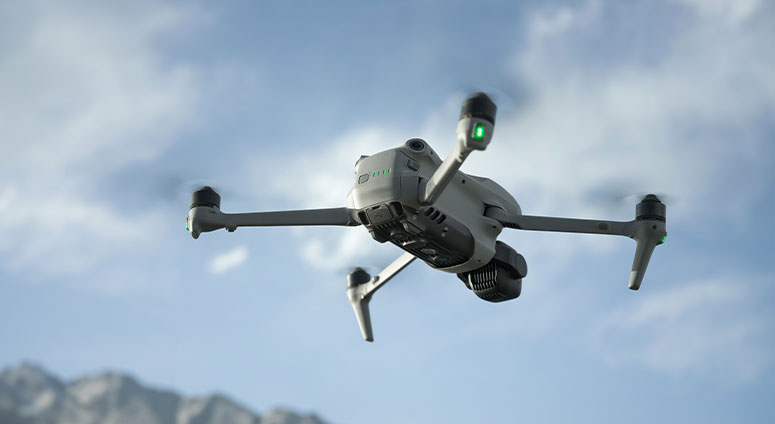
1. Drones: Your Wings to the Sky
Discover the best drones tailored to your needs—from compact, beginner-friendly models to high-performance rigs with 8K resolution and obstacle-avoidance systems. Compare features like flight time, stability, camera quality, and intelligent flight modes to find your ideal aerial companion.
2. Cameras: Precision in Every Pixel
Not all drones come with built-in cameras, and sometimes, you might want to attach your own. Explore top-tier action cameras, mirrorless systems, and specialized aerial lenses designed to capture crisp, vibrant footage even in challenging conditions. Learn about sensor sizes, dynamic range, and low-light performance to make every shot count.
3. Editing Software: Transform Footage into Art
Raw footage is just the beginning. Dive into the world of professional editing tools that bring your aerial visuals to life. From intuitive apps for quick social media clips to advanced suites for Hollywood-grade color grading and stabilization, we’ll help you choose software that matches your skill level and creative vision.
Why This Matters
Aerial content isn’t just about elevation—it’s about perspective. Whether you’re documenting landscapes, creating cinematic sequences, or inspecting hard-to-reach areas, the right gear and software can turn your vision into reality.
Ready to soar? Let’s find the perfect tools to elevate your storytelling to new heights!
I. Drone Deer Recovery
Drone deer recovery is a service that uses drones equipped with thermal imaging cameras to locate and retrieve downed deer, especially after a hunter has lost the blood trail or is unable to find the animal. It helps hunters save time, money, and emotional stress by efficiently finding their game in challenging terrains.
Here’s a more detailed description:
Core Function: Drone deer recovery utilizes drones, often with thermal imaging capabilities, to locate deer that have been shot but are not immediately recovered by the hunter.
How it Works:
Thermal Imaging:
Drones with thermal cameras detect the heat signature of the deer, allowing for efficient searching, even in low-light conditions or dense vegetation.
GPS and Mapping:
Drones can also utilize GPS and mapping technology to create a systematic search pattern and record the location of the deer.
Expert Pilots:
Trained drone pilots operate the drones, interpret the thermal data, and guide the recovery efforts.
Retrieval:
Once the deer is located, the pilot can guide the hunter to the location for retrieval.
Benefits:
• Efficiency: Drones can cover large areas quickly, increasing the chances of locating the deer.
• Reduced Stress: Searching for a lost deer can be stressful. Drones offer a less stressful alternative.
• Time Saving: Drones can significantly reduce the time spent searching for a lost deer.
• Ethical Hunting: Drone recovery minimizes disturbance to the environment and wildlife. Professional
Services:
Consultation: Professionals often offer consultations to assess the situation and plan the search.
Pricing: Costs can vary, but often include a pilot’s fee, drone operating costs, and potentially a success fee.
Expertise: Professional services bring experience in drone operation, thermal imaging interpretation, and navigation.
II. DJI
DJI, formerly known as Da-Jiang Innovations, is a Chinese technology company and the world’s leading manufacturer of civilian drones. They are known for their innovative aerial imaging technology and diverse range of drones for both professional and recreational use. Beyond drones, DJI also designs and produces camera systems, gimbals, propulsion systems, and software, with a significant impact on industries like filmmaking, agriculture, and public safety.
DJI‘s impact on the drone industry is substantial. They are credited with pioneering the widespread adoption of ready-to-fly recreational drones and developing the product category of highly capable off-the-shelf quadcopters. Their technology has become a preferred platform for aerial data collection in various sectors, including:
Filmmaking:
DJI drones and camera systems are widely used by filmmakers for capturing stunning aerial shots and cinematic footage.
Agriculture:
DJI‘s drones and specialized software help farmers with tasks like crop monitoring, spraying, and surveying.
Public Safety:
Emergency responders and law enforcement agencies utilize DJI drones for search and rescue, surveillance, and incident assessment.
Construction and Energy:
DJI drones are used for infrastructure inspection, surveying, and monitoring construction progress.
Other Industries:
DJI technology finds applications in a wide range of fields, including conservation, energy infrastructure, and more.
DJI’s commitment to innovation and user experience has solidified its position as a leader in the drone market. They emphasize ease of use, safety, and reliability in their product development, making their drones accessible to a broad range of users, from hobbyists to professionals.